|
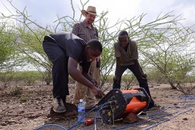
January 18, 2016 It was a relatively uneventful day today in the field. The chai mendazi are losing their novelty. And spooking camels away from our cables has become as routine as swatting mosquitoes in Alberta. Today, we continued to explore for water well drilling targets for the Turkana people living in and passing within close proximity to the UNHCR proposed 60,000 person Kakuma Refugee Camp expansion. The IsraAID WASH students are essentially now running the entire survey with the Calgarians simply supervising. We moved our survey area west, away from what appear to be areas of very high salinity. The results are looking better, and we may have a few targets in an area of saturated, fractured rock. We will continue our exploration in this area for two more days, and then move back to the Refugee Camp for a final day of exploration. Exploring in the Kalobeyei area was one of our main technical goals in the SEG (Society of Exploration Geophysicists) GWB (Geoscientists Without Borders) grant under which we are operating. (click photos for caption) The film crew of Brendan and Josie went in different directions. Josie filmed the opening ceremonies of IsraAID’s latest introductory WAMTECH (Water Management TECHnology) classes, including a women only class. Brendan carried on filming the IsraAID students and Calgary geophysicists in the field, occasionally stopping people in mid-machete swing for a short interview. It is likely his best footage today will be of Landon Woods again carrying 40 kg of cable on his back, but this time working his way through an impenetrable tangle of acacia and other thorny vegetation, and not smiling about it as in some of his cable laying ventures earlier in Laga Tarach.
0 Comments
January 17, 2016 One of the subtexts of the IsraAID programs in Kakuma is “peace building,” whether it is between rival tribes from Sudan, political rivals from Burundi, Christians and Muslims, and especially between the host Turkana and refugee communities. Rarely was this so timely as today, the day after an extreme level of tension in Kakuma town after the accidental death of a young Turkana child at a local health clinic. There is nothing like a long day together in the field, in the hot Turkana sun, pounding electrodes and planting geophones, to occasionally make, but usually break a little tension among Dinka and Nuer, Ugandans and Congolese, Darfurians and South Sudanese, or Turkana and refugees – and we certainly have representatives of all of the above and more in our IsraAID WASH student crews. Fortunately, as Calgary geophysicists, we are comfortably ignorant of the usual ethnic divisions, and divide the crews into other such tribal categories as ERT cable laying, seismic source operating, recording, GPSing, etc. In fact, there was a great sense of camaraderie today on both crews, in both the morning and afternoon shifts. Employing Turkana from the local Kalobeyei area, and having exploration goals intentionally benefitting the host community, seemed to bring a friendlier than usual crowd of Turkana herdsmen, along with their camels and goats and donkeys. Having a few extra helpers on the IsraAID student crews gave us quite a bit of time to talk during data acquisition and an extended lunch. Inviting the Kalobeyei village leader along with two area tribal chiefs for lunch, sitting in the shade of a large tree along the laga edge, further elevated the level of cordiality for the day. And an unusual 30 minute dry season downpour that drove us all under the shelter of a large acacia tree further added to the discourse time for the day. To date, we have collected about 6.9 km of ERT (electrical resistivity tomography) data, and about 3 km of seismic refracton data. We are certainly going to have some excellent targets for new water wells in the Kakuma Refugee Camp. Regarding the Kalobeyei area, after a dinner of ugali, rice, cabbage, and goat (for the 9th consecutive night), we did preliminary processing on the ERT data set collected in Elelia Laga, and a quick look at the seismic refraction data from Esikiriait Laga. Rarely are geophysical data absolutely definitive, but today’s data were definitive in their interpretation….and unwelcome. The subsurface of Elelia Laga was clearly saline, and the bedrock of Esikiriait Laga was clearly only a few meters below surface – not the thick water saturated sands and gravels we were hoping to find. We do have a Plan B for tomorrow, though, so stay tuned.
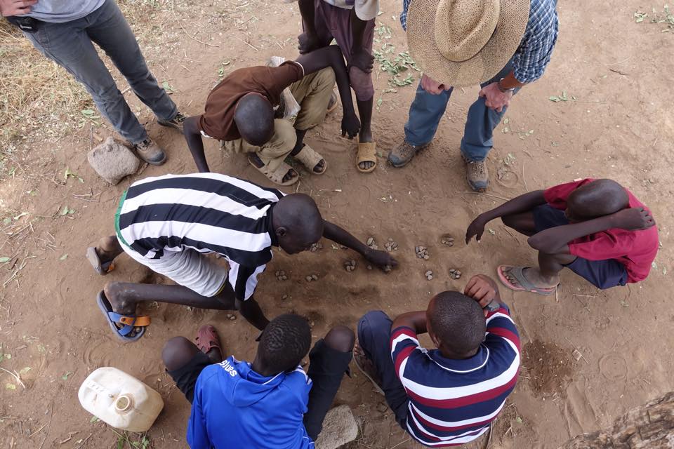
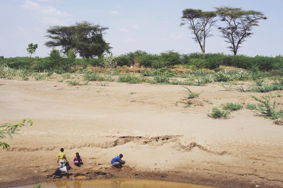
While most of our work days are bookmarked by chai mendazi (milk tea and donuts) in the morning, and a cold drink before dinner. Today, though, the return trip to Camp was announced with gunfire from AK-47s…and a cold drink. The morning was a bit unusual as well. Within the Camp, we have some broad goals from UNHCR, such as to site higher production wells in Kakuma 1, or site a few wells closer to Kakuma 3 and 4, but beyond that, we simply draw ourselves a line on the map of the Camp, and then go do what we believe we have to do to carry out the survey. The next few days, however, we will be exploring for water for the host Turkana community south of the 60,000 person Kalobeyei Camp expansion. As this is Turkana land, we had to of course to meet the village head and the two local chiefs in the existing Turkana village of Kalobeyei. It was somewhat reminiscent of doing work at a northern aboriginal reserve in Canada. There was no burning of sweet grass or shaking of rattles, though, as the village head man Alfred Kapoko got down to business right away. His demands were clear and reasonable, that is, if demanding anything of us can be termed as reasonable given everything we do is on our own time for the benefit of the refugees and Turkana. He wanted each geophysical crew to take on 3 Turkana helpers from the local tribe…check….pay them the going rate for the area….check….feed the workers…check….and promise to provide the report and interpretations directly to the village head….will do. As Alfred Kapoko said so succinctly….”projects come and projects go,” and after everyone leaves we never hear or see anything. Our requests were also quite clear….the refugee and Turkana students also stay on the crews….show us where you would like to drill your wells…and be sure to actually use our maps when it actually comes time to drill. And then we drove off into the Turkana desert to visit, view, and GPS their proposed water well locations as there is no way we would ever relocate ourselves in this flat, incised and dissected, confusing landscape. Why would anyone ever choose to live in this harshest of landscapes?....well, they would not, not even the nomadic Turkana. But the village head Kapoko explained that once the Camp is built and the Turkana see water being piped to the Refugee Camp from Turkana land, the Turkana will build communities on the edge of the Camp. And if they are not provided with water, they will take it, by tapping into pipes or entering the Camp. He explained that Turkana are pastoralists, and while even in this desert landscape there is enough vegetation for the herds, water is the determining factor in their lives. We entered three different lagas (dry river beds), Kangura, Esikiriait, and Elelia, where the Turkana hoped the drilling prospects would be good. As it is only a month since the rains ended, there were still a few nomadic groups camped near shallow “scoop holes” dug out of the sand in the bottom of the lagas, from which they could scoop enough water to survive, but these would disappear in a few weeks at most, leaving the herdsmen no choice but to move on. Finishing up at Kalobeyei, I drove back to meet the electrical tomography crew lead by Erin and Randy on the west side of Kakuma 1. They had finished the day’s planned survey, and were busy getting some lessons on playing Mankala from a few young refugees passing time on a Saturday. Besides being an African game, Mankala is probably the most common game in Kakuma as it is easily played with stones and a board pattern easily dug out of the sand. Driving back to our compound, I stopped to take a few photos of some the more ludicrous billboards in the Camp. “Eat at least 3 balanced meals.”….most refugees would be happy with one. “Avoid taking tea or coffee with meals because they interfere with iron absorption.”……if only there was coffee here (besides Franco’s Ethiopian establishment of course)!, and if only refugees did have something to eat with the cup of tea they are unlikely to have in the morning. “Exclusive breast feeding for six months prevents malnutrition.”… who does not have malnutrition here?! “To prevent being infected by malaria everybody should sleep under a mosquito net”…what about a proper house and roof and bed? Etc. Moments after passing the mass of people at the Refugee Hospital, the mobile phones in our 4 X 4 starting ringing with reports of gun fire near our compound…lots of it. The Kenyan in our 4 X 4 immediately thought of the Somali terror group and Al Queda spinoff Al Shabab, a notion I immediately dismissed as who would carry out a terror attack in a place that no one has heard of or cares about! – and in fact, there has never been a terror attack in Kakuma. 15 minutes later we pulled into the LWF compound where we store our equipment. One woman who had just completed 3 years of NGO service in war torn South Sudan immediately identified the weapons as AK47s, range 500 to 700 m. A few minutes later this was confirmed by a few of our staff who were back in their rooms…about 500 m away. Apparently, a Turkana woman had brought her child to a clinic in Kakuma town. As the latest version of the event goes, a nurse had given the child a shot, then finished her shift. A second nurse had replaced the first, and without consulting the Turkana mother, quite possibly due to a language gap, the second nurse had given the child the same shot again. The child died immediately, and Turkana started to mob the clinic. The police let off a few shots to clear the crowd; but for Turkana, gunshots are like a dinner bell, and they crowded the streets and the town in mass. Supposedly, the Turkana have more assault rifles per per person than anywhere in the world as they need them to protect their lives and their livelihood, herding livestock. Eventually, though, the commotion calmed down, and the Turkana dispersed. The child’s body was taken for an autopsy to the Refugee Camp Hospital where we had passed on our return. Besides the unfortunate victim of what seems to be simply a mistake, no one was reported hurt from any of the gunfire. I suppose it is not surprising that in a place where one’s hold on life is so tenuous, tensions are always ready to be released at any provocation, especially as tragic an incident as this.
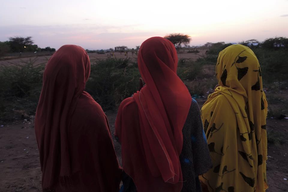
Today, we drove again from the southern end of the Camp back to the northern end, to continue to map out Kakuma’s best aquifer. It’s a fascinating drive in the morning, perhaps one of the most engaging and thought provoking 10 km or so of human interest on this planet…past UNHCR’s solid waste disposal facility (an open trash burning pit), passing the oldest of several Kakuma cemeteries on the right (crosses for Christian burials and low stone piles for others, like many desert burials of eons past), through the Block (the Camp is divided into Zones and Blocks) where the 40,000 “Lost Boys” of Sudan first came in 1991 and 1992, past a small stockyard full with cattle destined for one of two abattoirs in the Camp, past thousands of refugees going to school (one of the primary schools has 7,000 children!), past long line ups at one of the food ration distribution centers, passing dozens of signs such as the one in front of the hospital extolling people to eat 3 well balanced meals daily comprising all the food groups (rations will decrease 20% this year to approach 500 calories, explaining why most refugees eat a single simple meal daily), catching sight of something you NEVER see here …an overweight person, through the Somali market, then the Ethiopian market, then the market in Kakuma 2, a roadside sign pointing to Kalobeyei – a Camp that does not yet exist, the Lokado center for charcoal stove making, the Red Cross Center for searching for family contacts, the Don Bosco technical training center, Somali women in hijabs, Sudanese women in sarongs, very young children rolling old bicycle tires or pulling small plastic cars made from cracked bleach bottles or jerry cans, the crowds surrounding the UNHCR postings of interview lists for possible immigration to Canada or Norway or the United States…across tributaries to the main Laga that were in raging flood stage only 2 months ago, under the towering tanks that replenish the water taps serving 185,000 refugees, the early morning crowds of women and children squatting outside the only hospital in the camp…. And then we get to the northern well field, and it is back to Turkana women carrying everything and anything on their heads, small boys and girls herding camels and donkeys and goats, and everyone carrying or rolling or dragging jerry cans of water. It was our third day working in this particular water well field. If only things were so easy back in Canada…not only are our Turkana and refugee students better trained by the day, but the local Turkana kids are always eager to show that they can carry anything we can, heavier, further, and faster. And the Turkana seem to be the masters of untangling hopeless knots of seismic cable that we Canadians seem to be the masters of creating.
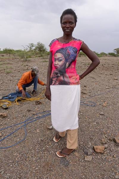
Most days we are swallowing a liter or more of water an hour and still feeling dissatisfied. Today, the day was overcast, and we even had a bit of rain. And working in the forest north of camp provided that extra bonus of shade. A preliminary look at our results suggests that the northern area is a thick blanket of saturated alluvial and volcanic sands…so if we can map out that blanket, we can certainly site a few more wells. As we had 4 Turkana on our crew during lunch – William, Asha, Peter, and Loki, I threw out a question that has been nagging me…what does”Kakuma” really mean? The popular response of those who work here is that Kakuma means “nowhere” in Swahili, though Google Translate nor my Kiswahili dictionary support this assumption. The Turkana students provided, with great confidence, several conflicting answers, including Kakuma being a plant that is unique to the area, a ridge of hills nearby, the name of a tobacco pouch commonly used by the Turkana in the area... Later, back in the IsraAID office, one of the South Sudanese refugees and WASH instructors, Michael, said it came from a combination of the Nuer words Kak, for farmland, and Uma, meaning of the government. This would explain the stress on the first syllable instead of the inviolable rule in Kiswahili of the stress being on the penultimate syllable. But my favorite, and most believable explanation, came from the well spoken 20 year old Kakuma born FilmAid actress, WASH superstar, and also occasionally known as Miss Kakuma, Teresa. Kakuma is a Dinka word of South Sudan, describing this area when Dinka and others were exiled here, in the years before Kenyan independence in 1964, when the Turkana desert was considered (at least by Sudanese and nomads of the area) as part of Sudan. It means “the place where you will be punished.” 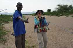 Peter and Erin laying cable and placing electrodes in the Laga (dry river bed) near the Well 4 cluster and several hand dug wells at the north end of Kakua 1. Kakuma 1 was the original camp of the Lost Boys of Sudan when they first arrived, beginning in 1991. Our plan for our first few days of surveying is to tie our lines to existing boreholes so as we can develop confidence in our interpretations of the data.
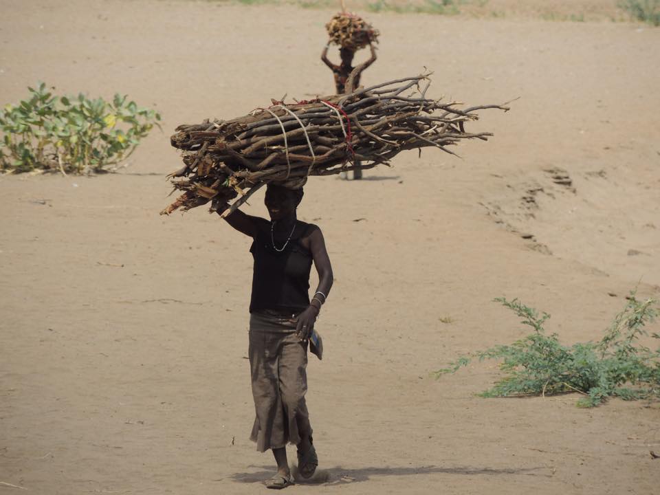
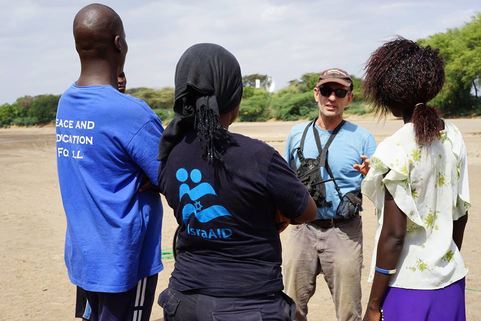 Paul explaining the plan for the afternoon to 3 Turkana students, from left, William, Asha, and Lokitoe (Loki). All 3 students graduated from IsraAID’s advanced 8 month WASH (WAter, Sanitation, and Hygiene) course, and have already been introduced to field geophysics and water exploration through the course. #tbt to the first time in KakumaOn my first trip to Kakuma and the Kakuma Refugee Camp in October 2014, I taught a 2 week course in groundwater and geophysical water exploration to students who consisted of refugees and host community Turkana. This short course was part of a larger WASH (Water, Sanitation, and Hygiene) program presented by the NGO (Non-Governmental Organization) IsraAID. Besides improving the overall water situation in the Camp, the program was designed to improve peoples' livelihoods by giving them the tools needed for further education, employment or internships with the Turkana County public utility, or opportunities with other NGOs working within the Camp. It was through this experience I was able to see and hear first hand the challenges of water supply in this remote corner of Kenya. It was this knowledge that prompted me to prepare the technical material for an IsraAID application for a humanitarian aid grant with the GWB (Geoscientists Without Borders) foundation of the SEG (Society of Exploration Geophysicists). Why would 7 Calgarians voluntarily come, again referring to Dave Eggers biography (Achak Deng’s autobiograph) What is the What, to “a place in which no one, simply no one but the most desperate, would ever consider spending a day?” Achak Deng goes on to expand on his initial impressions of Kakuma in 1992,after walking across the deserts and swamps of Sudan…”it is not the worst place on the continent of Africa, but it is among them.” Fortunately, we don’t have a lot of time to think about why we are here, as our days start with a 6:30 AM loading of equipment, chai mendazi, a drive to our next survey location, a long day of field work, shower, dinner, data processing and sleep…not much different than home, and those 38 degree temperatures and the punishing sun keep one from getting too philosophical. Today, we were back in the Turkana community immediately north of the Camp, carrying out a seismic survey to find the areas of deepest bedrock. While the bedrock (that is the volcanic rock underlying the overlying sands and clays) is sometimes a productive aquifer, the water produced from the bedrock aquifers is often very high in fluoride. Fluoride is one of those elements that is very healthful in low concentrations, but can cause dental and skeletal fluorosis at high concentrations. As such, our objective in this northern area is to search for areas of deeper bedrock where high water production wells with low fluoride concentrations can be drilled. Even this close to Kakuma town, the Turkana in this area are largely pastoralists, living in igloo like structures called manyatas, made of branches and leaves, and built in a half day by the women. They take advantage of a water tap located in the wellfield, but otherwise their livelihoods are derived from their livestock, and perhaps selling wood or charcoal to the refugees for cooking fuel. The well field where we were working today is one of the few forested areas of Kakuma. Young children can be seen high in the trees chopping away at branches with machetes to harvest cooking fuel. A large bundle of firewood will fetch 100 Kenyan shillings in the Camp, or about $1; a bundle of not too crooked branches to be used for building fences or roofing in the Camp will bring $1.50. All day women were passing along our lines balancing massive bundles of wood on their heads, and often carrying 20 liter jerry cans of water as well. Of course they would often stop by our seismic recording station to quality control the data, and perhaps to see if we had any extra chewing tobacco. IsraAID’s Turkana and refugee students are now largely running the seismic surveys, including planting geophones, running the GPS, laying cable, operating the truck mounted seismic source, and doing those things that Turkana are particularly good at such as keeping goats off the line and camels from eating our cables. The shooting went faster than expected today, so Colin Miazga and Franklin Koch, our University of Calgary Ph.D. intern, gave the students a late afternoon data processing tutorial. Of course I expect we will get payback with a far more interesting tutorial on cattle raiding that our Alberta farm boy Landon Woods in particular can benefit from. We finished the day by walking on the bridge across Laga Tarach for nyama choma – roasted goat meat – at the White House, one of three such establishments in Kakuma along with Camels and Unity. In a town that is off the grid and has enough generators to power a few light bulbs, but certainly not a refrigerator, you can usually be confident that at least your food is either canned or very fresh.
Wednesday January 13, 2016
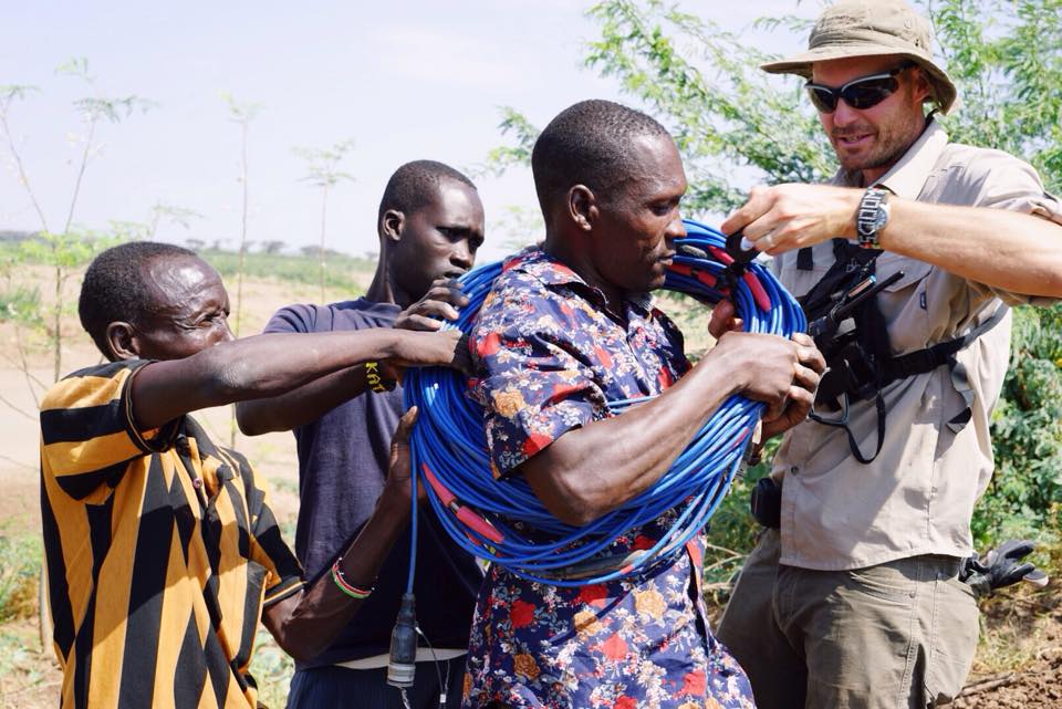
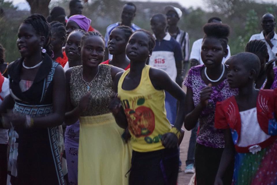
It is the first day we finished well before dark. We certainly had time to collect more data, but a few stressful incidents persuaded us to call it quits after we had reached our primary goal for the day. We worked today in a well field 2 kilometers north of the Camp. The geology of Kakuma is very simple – and very complex. It’s simple because it is essentially the edge of a basin, or let’s say a dish, filled with sediment. It’s complex because that dish is made of a variety of volcanic rocks, and the depth of that dish rapidly varies with the volcanic rock sometimes coming to surface, and then quickly deepening to many tens of meters. And the sediment can be sand, clay, volcanic gravels, sand and clay, saturated with fresh water, saturated with salt water, or all of the above. Complex geology makes the interpretations of the geophysical results complicated and uncertain. So, to remove some of the uncertainty, we try to run our geophysical lines through boreholes of known geology. Of the 50 or more boreholes in Kakuma, only 10 or so have good geologic descriptions; and of those, only 6 or so actually intersect bedrock. So in these early days of our program, water well BH7, about a kilometer north of the Camp, was an important well through which to run our survey. And being outside of the Camp, we thought the going would be easy – no soccer games, no kids playing tug-of-war on our cables, no throngs of curious onlookers in a place where there simply is not much to do. Unfortunately, we were wrong. Soon after unloading our gear and locating the well of interest, we started scouting the line….no refugees, but thickets of thorny acacia, herds of camels and goats and donkeys (all for food), and a maze of thorn fences comprising Turkana compounds and corrals. Fortunately, Jack of IsraAID had done a great job of making sure there was at least one Turkana WASH student in each field crew. With Peter Kuya, we worked our way down our planned line, slashing away at brush with machetes, and explaining to the Turkana elders that we were exploring for water, we were not exploring for oil, the information could be used for refugees and Turkana, etc. And lots and lots of hand shaking and greetings in Turkana and Swahili. After a few hours of this we thought we had the green light, and began laying cable. That’s when the head of the village came out waving his goat herding stick and looking angry. “We Turkana never benefit from any of these boreholes!” Meanwhile, 30 m away there is a water tap from BH7 that all morning has seen a steady stream of Turkana men bathing, Turkana women filling UNHCR water containers, Turkana boys carrying buckets of water for livestock, etc. Reasoning was not going to get our survey going, though, but some Turkana-to-Turkana negotiating with our Turkana student eventually got things moving again…that is, until 5 very tall and very angry young men, with very sharp Turkana wrist knives, jumped from inside one of the thorn fenced compounds waving sticks and arms in threatening gestures. Peter Kuya, our Turkana student, was out front with a machete clearing the line. I suggested he put his machete down, a notion he found nonsensical considering the circumstances. Eventually and quite surprisingly, to the rescue came the previously hostile village headman. He calmed things down and got our survey back on track. By early afternoon we had collected what we needed and picked up our instruments and cable. The 40 degree heat and the events of the day convinced us to close up shop early, but not before collecting 800 m of ERT (electrical resistivity tomography) data looking to a depth of 120 m. Meanwhile, our second crew collected 585 m of seismic refraction data tying into the UNHCR borehole to the south. 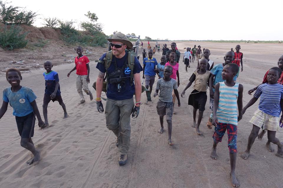 Geophysicist Landon Woods is carrying a 40 kg backpack with 250 m of cable, but I don’t think that is what he is smiling about. The children following Landon are mostly refugees, with a few Turkana. The Kakuma Refugee Camp is on the west side of Laga (dry river bed in Turkana) Tarach, with the host community Turkana living on the east bank as well as all other surrounding areas. After school, the Laga is full of hundreds of kids running, teaching themselves gymnastics moves, playing soccer, along with hauling water back to their homes…unless of course there is something much more fun to do, like watch Landon spool 1,000 m of cable and then carry it across the soft but burning sand in the oppressive afternoon heat. We use long arrays of cable for both our ERT (electrical resistivity tomography) and seismic refraction surveys. Though this is my third visit to Kakuma, last Sunday was my first opportunity to view the Nuer dancing of South Sudan. On my previous visits the dancing was cancelled because of inter-tribal violence or rain. As the only non-Nuer were the Calgary geophysicists and film crew, the event certainly was NOT put on for tourists. Besides maintaining cultural traditions while in a foreign land, the dances obviously also serve the function of providing an opportunity for young men and women to meet in a social environment. As such, many of the refugees appear in the finest clothes they can find. --Paul Bauman
KakumaMonday and Tuesday, January 11 and 12, 2016
We have divided into two crews of Calgary geophysicists, and each crew is working with 3 or 4 refugees and Turkana drawn from the IsraAID 2015 advanced WASH (Water, Sanitation, and Hygiene) class. The students are very keen. It is an opportunity to get more practical field training in what they learned in their previous 8 month course; they are provided breakfast (chai mendazi of course – milk tea and donuts) and a very filling lunch of ugali (maize paste), rice, vegetables, and goat meat; close interaction with the Calgary geophysicists; and pay of course. Both Monday and Tuesday we worked in the main laga (Turkana for wadi, or dry river bed), Laga Tarach. The open expanse of the Laga, the proximity to the Camp, the ease of driving along the river bed, and the large number of wells located along the Laga made it an ideal location to begin. On the Monday one crew collected 1.6 km of deep (120 m) looking electrical resistivity tomography (ERT) data imaging depth to bedrock, and therefore the areas of thickest water bearing sands and gravels. The other group did a similar survey, but looking less deep (70 m) with higher resolution. For both groups, things went fairly smoothly until late afternoon when thousands of school kids are released, and descend into the Laga to play soccer, roll tires, practice kung fu moves, and tag along with any geophysical survey that might be taking place. Tuesday was similar, except we broke into a seismic refraction and ERT crew. The refugee and Turkana students are catching on very quickly, operating the GPS units, the seismic source, laying cable, placing geophones, and essentially doing most elements of the field programs that we would normally be doing ourselves. |
Categories
All
Archives
August 2022
|
 RSS Feed