|
This article appeared in today's issue of the Times of Israel, announcing NOVA's April 19 premier of "Holocaust Escape Tunnel" on all PBS stations in the United States.
Besides locating the Escape Tunnel from Pit 6 (where the "Burning Brigade" was confined, and what we call "Soviet Pit 1" (the first and largest of the extermination pits), we better pinpointed what we believe is the trench in the photograph. Alastair McClymont and Paul Bauman used electrical imaging to identify the fill material in the trench. We created a very high resolution digital elevation model (DEM) with contours of about 2 centimeters so as to see the subtle but distinct linear subsidence of the earth associated with the trench. And we used induced polarization to identify metal objects in the trench. The victims were blindfolded, and marched through the trench into Soviet Pit 1. The archaeologists believed that as the victims heard gunshots from the Pit, and knew that they were being marched to their deaths, they would have emptied their pockets of their few remaining and most personal belongings, hoping that some day they would be found. As such, small metal objects identified in the geophysical surveys may provide more information about who these people were, and what was of greatest importance to them during their last few living moments. Later, the Nazis and collaborating Lithuanians abandoned the use of the trench, and simply marched Jews directly into the pits, or up to the edge of the pits, and usually shot them in groups of tens.
0 Comments
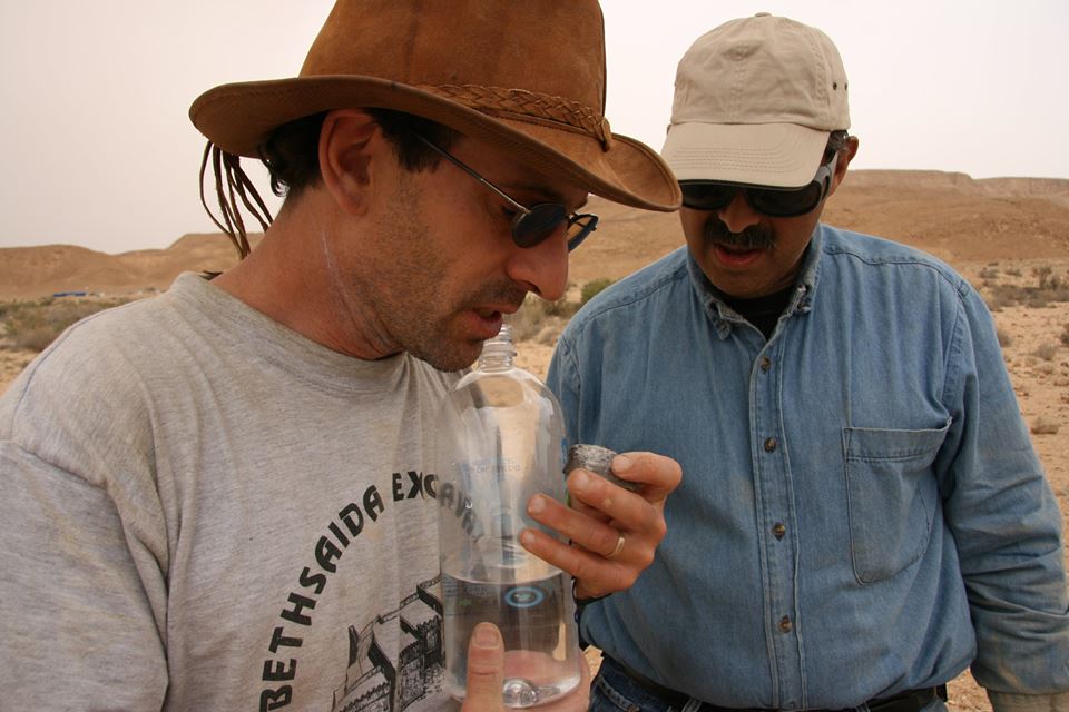
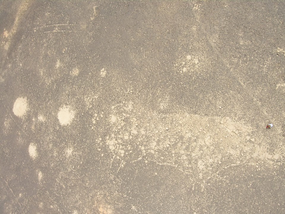
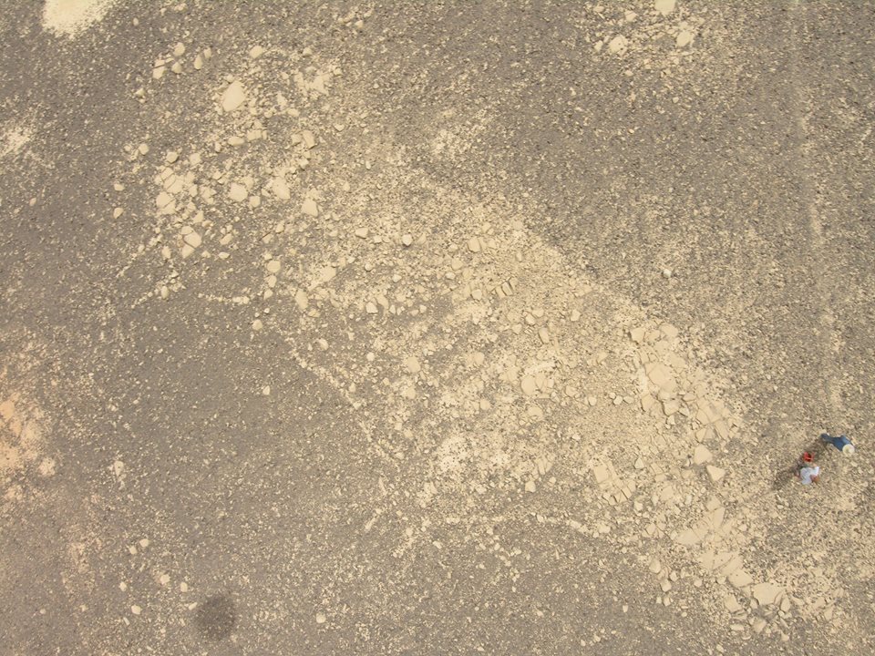
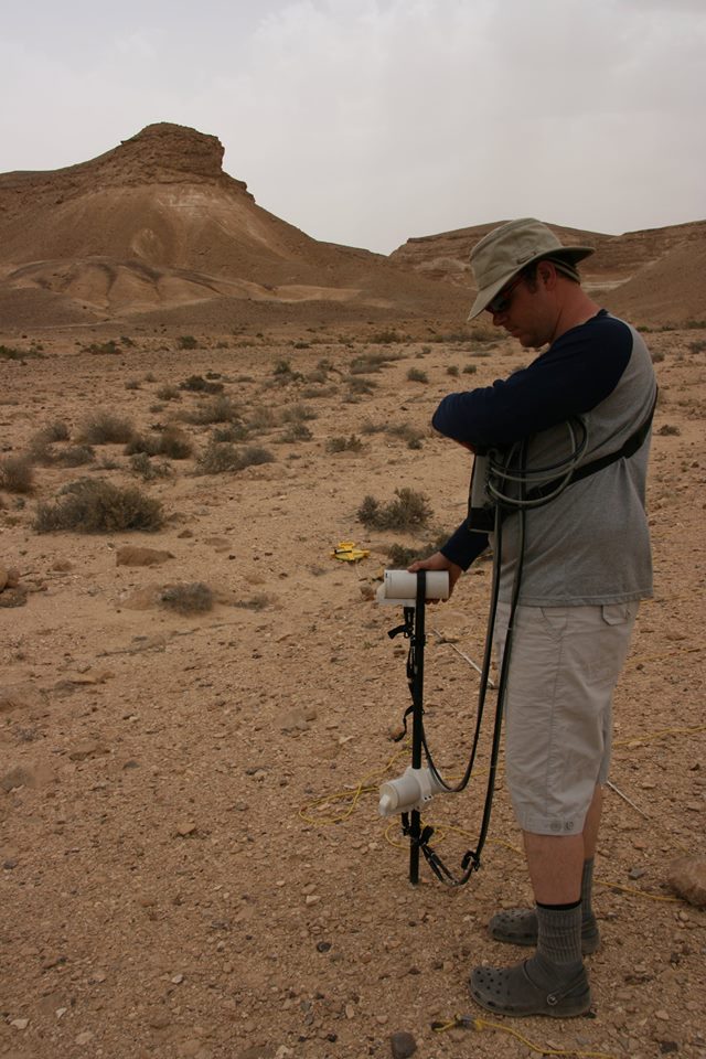
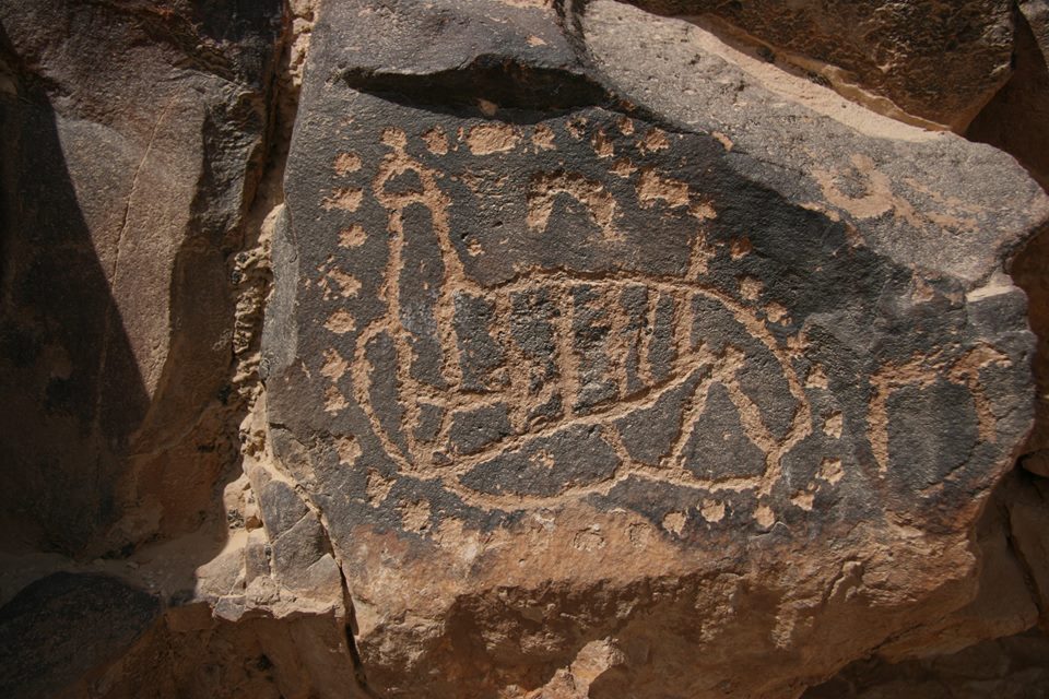
The Jewish holiday of Passover, being celebrated now by Jews everywhere, commemorates the exodus of the Jews from slavery in ancient Egypt, as described in the Book of Exodus in the Bible. A conundrum for archaeologists and historians of this period was the near complete lack of any physical or documented evidence for such a mass movement of people from one of the greatest empires in world history. And one thing for sure, agreed upon by all serious archaeologists and historians, is that Mount Sinai in the Southern Sinai Desert certainly is not Mount Sinai of the Bible where Moses received the Ten Commandments.....there is not even a single pottery sherd there that could be dated to within even a few hundreds of years when these tens of thousands of Jewish slaves may have camped there. In 1954, the Italian archaeologist Dr. Emmauel Anati first came to a mountain in the Negev Desert of Israel, attracted by the spectacularly plentiful presence of ancient rock art in the area. In 1980, Anati returned, and would continue to return for the next 30 years and beyond, convinced that Har Karkom was in fact Mount Sinai. In early April, 2007, under the direction of Dr. Richard Freund now of the University of Hartford, myself and my colleague, Chris Slater, used geophysics and aerial photography from weather balloons and kites to assist Dr. Anati in his explorations. In fact, we spent Passover and enjoyed our Passover meals beneath the shadow of Har Karkom, partaking heavily of Italian wines and foods - no pasta of course - brought by the Italian archaeologists. There is a great deal of evidence to support Anati's hypothesis; in fact, in 2010 the Vatican accepted his ideas. I will try to lay out some of the pieces of the puzzle during this Passover holiday. Some of the more astounding of our finds were geoglyphs - giant rock art visible only from the air, created by removing the overlying weathered rock and revealing the underlying white, unweathered rock. The best preserved of these geoglyphs was that of a wild boar, pictured here. Now this geoglyph pictures neither an animal that would be in any way considered Kosher, not could be dated any closer to the present then, say, 40,000 to 100,000 years ago. This would be at least more than 35,000 years before the Exodus. But this rich collection of rock art and geoglyphs clearly tells us that ancient peoples have been migrating across this area for tens of thousands of year; and, it is likely that the Israelites would have crossed the Sinai Desert along an established and more secure route such as this one. Geoglyphs, rock art, sacrificial altars, and various monuments all indicate that the environment of Har Karkom has been held in reverence for as long as perhaps 200,000 years. Of course there were other more recent artifacts that certainly were evocative of the Biblical period, for instance, the pictured rock drawing that could be interpreted as a map of Har Karkom, divided into 12 areas suggesting the twelve Tribes. And even Har Karkom itself, seen in the distance beyond Chris Slater and the magnetometer, eerily evokes the image of the Sphinx, from where the Israelites fled. I will show pull out other images of geoglyphs rock art, artifacts, and intriguing geophysical data over the Passover period. |
Categories
All
Archives
August 2022
|
 RSS Feed