PAUL BAUMAN GEOPHYSICS
  • Home
  • Blog
  • WHAT WE DO
    • Water Exploration >
      • Calgary to Kakuma Water Project | Kenya
      • International Committee of the Red Cross | South Sudan
      • Rohingya Refugee Camps | Bangladesh
      • 250 Villages in Mangochi District | Malawi
    • Community Water Supply >
      • Acholiland Community Water Supply | Uganda
      • 2004 Boxing Day Tsunami | Indonesia
    • Archaeology >
      • Great Synagogue of Vilna | Lithuania
      • Holocaust Escape Tunnel | Lithuania
      • Israel Sites
      • Rocky Mountain House National Historic Park | Canada
      • Western Wall Tunnels | Israel
    • Mass Grave Mapping >
      • Lithuania Sites
      • Poland Sites
    • Pop Culture >
      • Finding Escobar's Millions | Colombia
      • Japanese Gold of WWII | Phillipines
      • Searching for Atlantis | Spain
  • WHO WE ARE
  • news
  • Contact

Searching For and Mapping of a Hudson’s Bay Company Fort

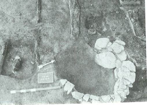
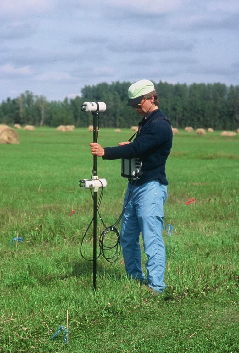
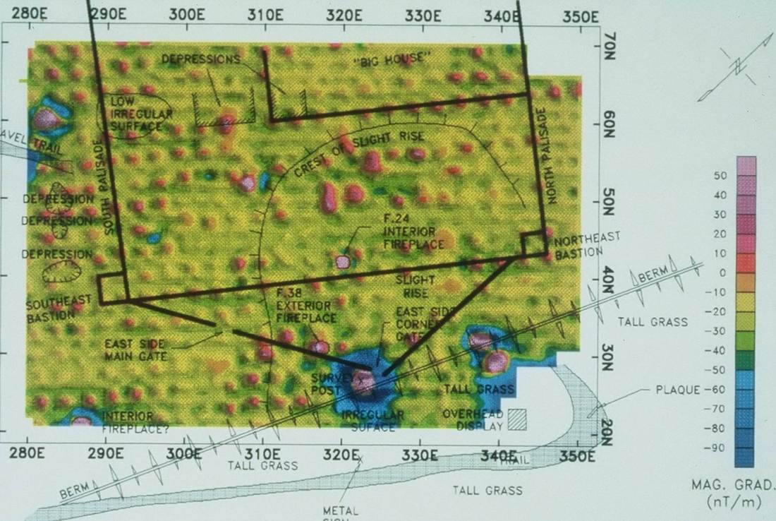
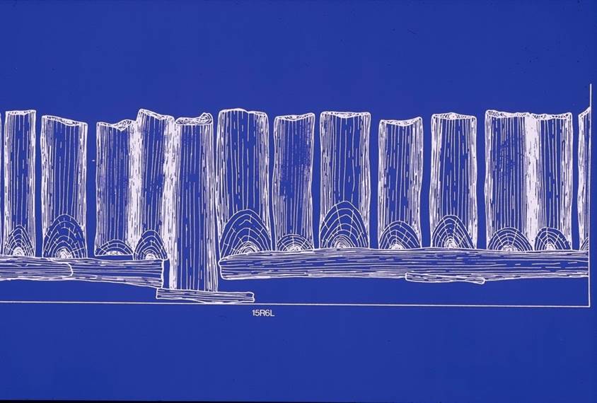
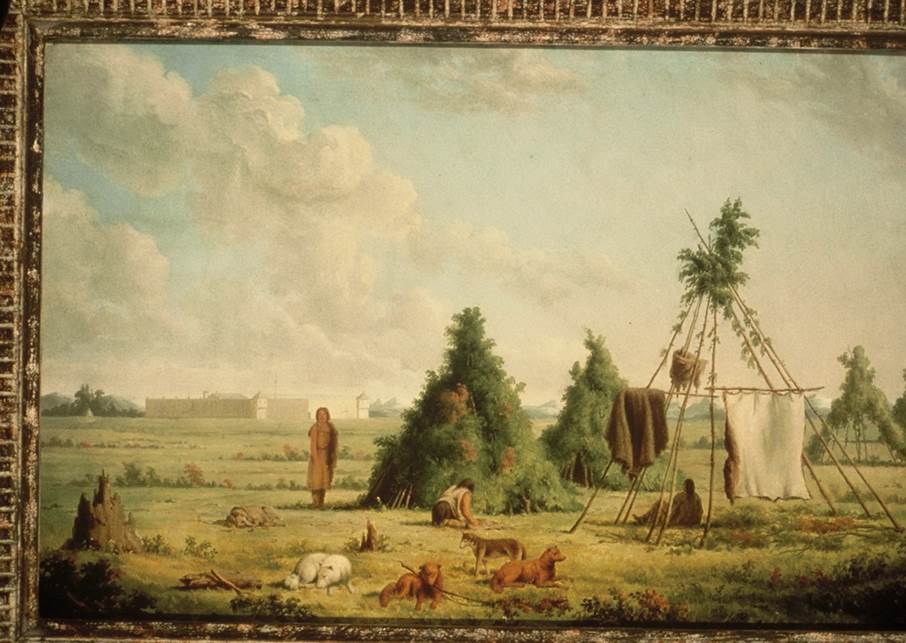
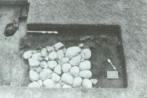
In 1835, the Hudson’s Bay Company built a trading fort at the confluence of the Clearwater and North Saskatchewan Rivers.  In 1861, after the traders had abandoned the Fort, the Kootenay Indians burnt the Fort to the ground.    With not a trace of the Fort visibly evident, in July 1991, Parks Canada asked if geophysical methods could be used to precisely locate the Fort, and perhaps even map the architecture.  When the Fort burnt, each of the deeply buried king posts baked the surrounding soil above the Curie point, imparting a small but measureable magnetic anomaly.  A magnetic gradiometer was used to map the burnt king posts, as well as the interior (square) and circular (corner) hearths that had also been subject to burning and high temperatures.  We had some idea what the Fort looked like from an 1846 Paul Kane painting.

    Join the mailing list to stay up to date! 

Subscribe to Newsletter
Copyright © PAUL BAUMAN GEOPHYSICS 2019
  • Home
  • Blog
  • WHAT WE DO
    • Water Exploration >
      • Calgary to Kakuma Water Project | Kenya
      • International Committee of the Red Cross | South Sudan
      • Rohingya Refugee Camps | Bangladesh
      • 250 Villages in Mangochi District | Malawi
    • Community Water Supply >
      • Acholiland Community Water Supply | Uganda
      • 2004 Boxing Day Tsunami | Indonesia
    • Archaeology >
      • Great Synagogue of Vilna | Lithuania
      • Holocaust Escape Tunnel | Lithuania
      • Israel Sites
      • Rocky Mountain House National Historic Park | Canada
      • Western Wall Tunnels | Israel
    • Mass Grave Mapping >
      • Lithuania Sites
      • Poland Sites
    • Pop Culture >
      • Finding Escobar's Millions | Colombia
      • Japanese Gold of WWII | Phillipines
      • Searching for Atlantis | Spain
  • WHO WE ARE
  • news
  • Contact